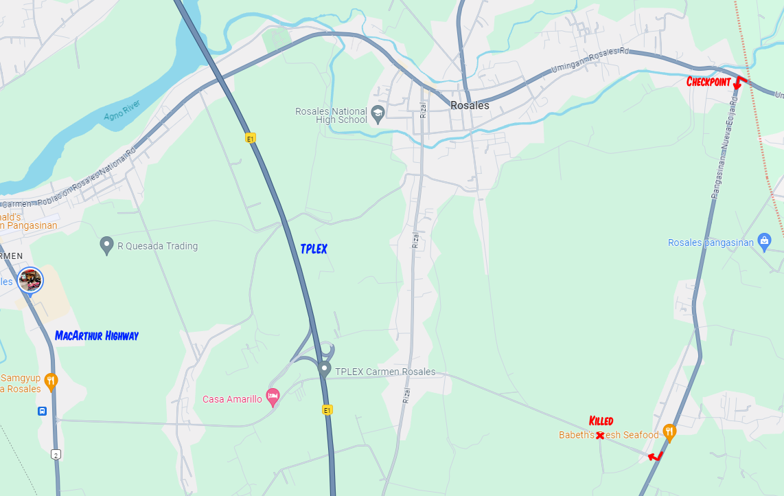
Map of Joshua Laxamana's police killing

Description
A map around Rosales, Pangasinan, Philippines near where the police allegedly killed Joshua Laxamana. The police chase started at the checkpoint intersection (red arrow in the upper right) after the suspect came from Balungao, Pangasinan, in the east. The chase continued on Pangasinan-Nueva Ecija Road until the suspect turned right into Cuyapo street (TPLEX access road) where he lost control of the motorcycle, crashed, allegedly fought back, and was killed.
This map also shows how far the crime scene is from Tarlac-Pangasinan-La Union Expressway (TPLEX) and MacArthur Highway, two main routes that lead to Tarlac City, Tarlac from Urdaneta, Pangasinan.
The dotted red line in the upper-right near the checkpoint indicates the boundary between Rosales and Balungao, Pangasinan.
Map screenshot taken from Google Maps.